3.2.7. Digitizing Catchment Areas
3.2.7.1. General
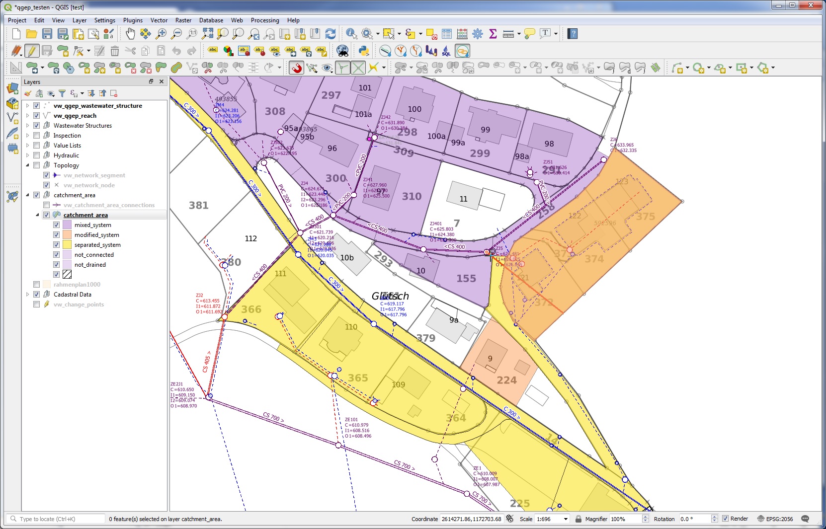
Catchments can be digitized with QGIS standard tools.
Catchment areas should not overlap and can have 4 connections to wastewater nodes.
3.2.7.2. Digitizing
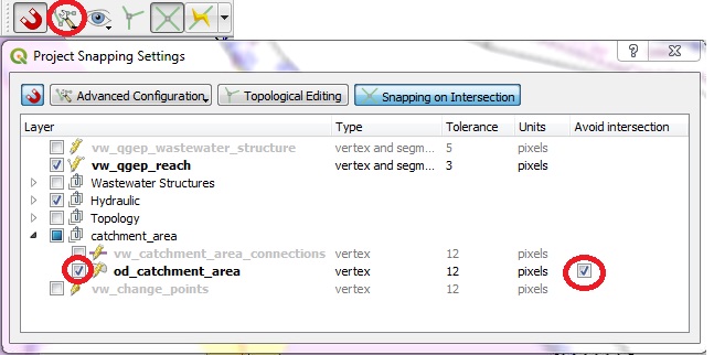
Select the Enable Snapping button

Open the Project Snapping Option Settings, check the od_catchment_area layer and check the avoid intersection checkbox for the od_catchment_area layer
Note
New digitized catchment areas will not overlap with existing areas with this settings.
Set the layer
od_catchment_areainto the edit mode.Use the Add Feature tool to digitize a new area.

Start digitizing with left click and continue with left click for every vertex of the polygon
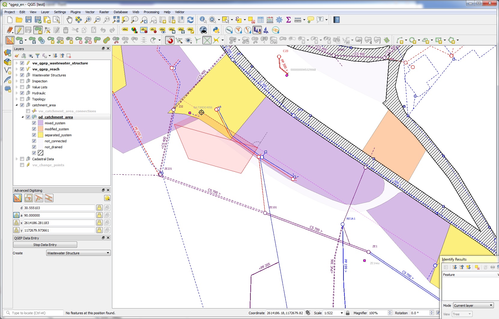
Stop digitizing with right click
Note
Keep in mind, that the finishing point of the polygon is the last point where you left clicked.
The od_catchment_area form appears
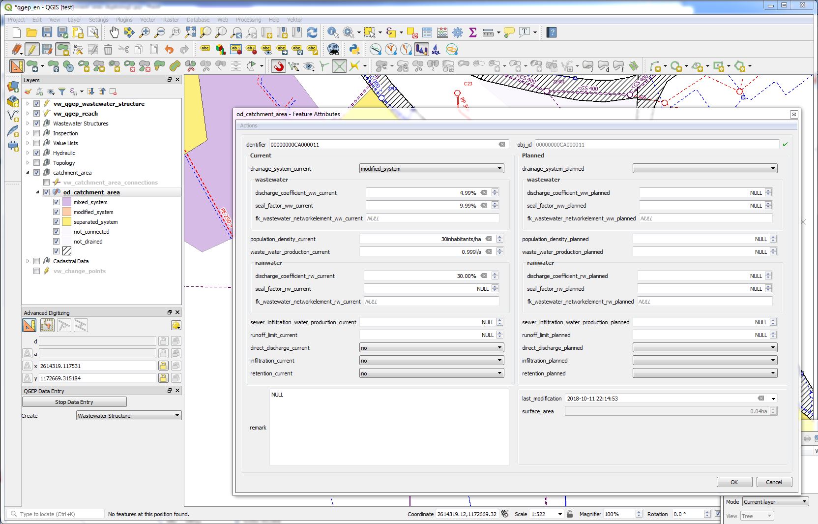
When finished editing attributes, click the OK button
Note
The new area does not overlap the old areas.
Note
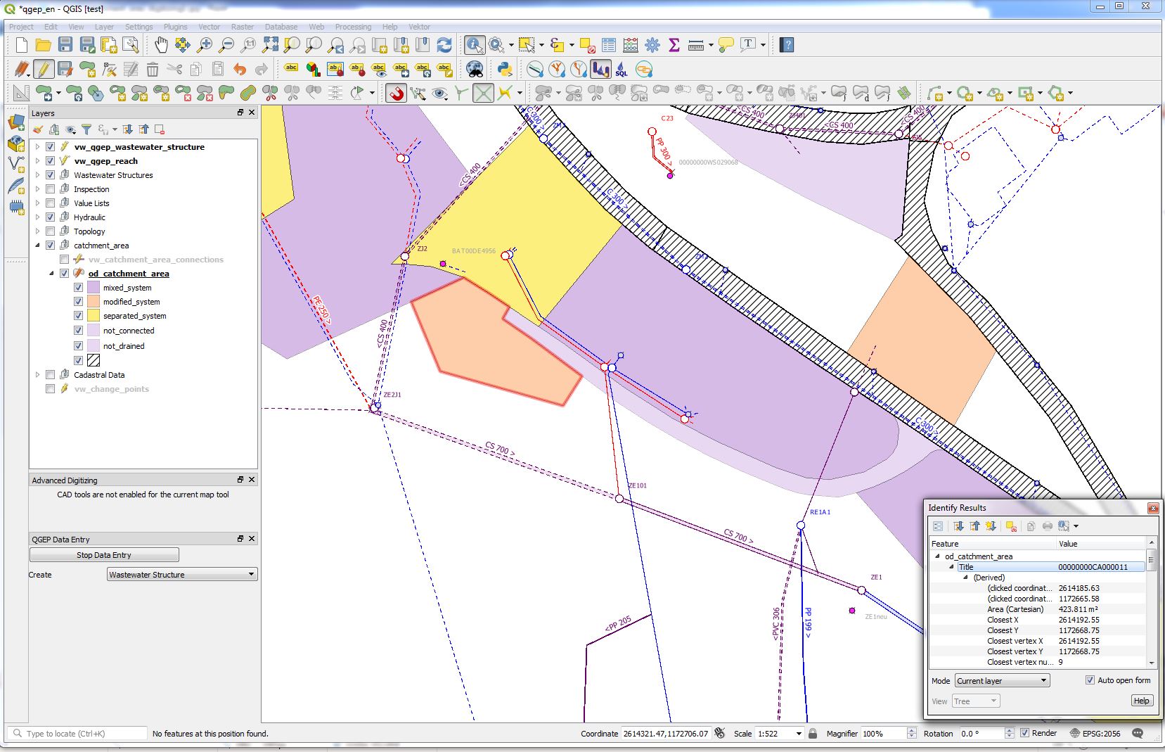
To control the exact area of a selected polygon, see in the Identify Results window under (Derived).
Note
To connect the area with wastewater nodes, see chapter Connect Wastewater Network Elements.
3.2.7.3. Editing
You can edit existing areas with the Identify features tool.

Note
There are ideas to have a menu in the feature attribute window, that allows you to copy all current-values to the planned-fields. Not realized yet.
3.2.7.4. Split Areas
You can split existing areas with the Split tool.

There is no need to select the area first. Left clicks to define the splitting line. Right click after having defined the last point of the splitting line.
3.2.7.5. Merge Areas
You can merge existing areas with the Merge selected Feature tool.

Selected the od_catchment_area layer an set it into the edit mode
Select at least two areas you want to merge
Click the
Merge selected Featuretool. -> The Merge Feature Attributes windows appears.
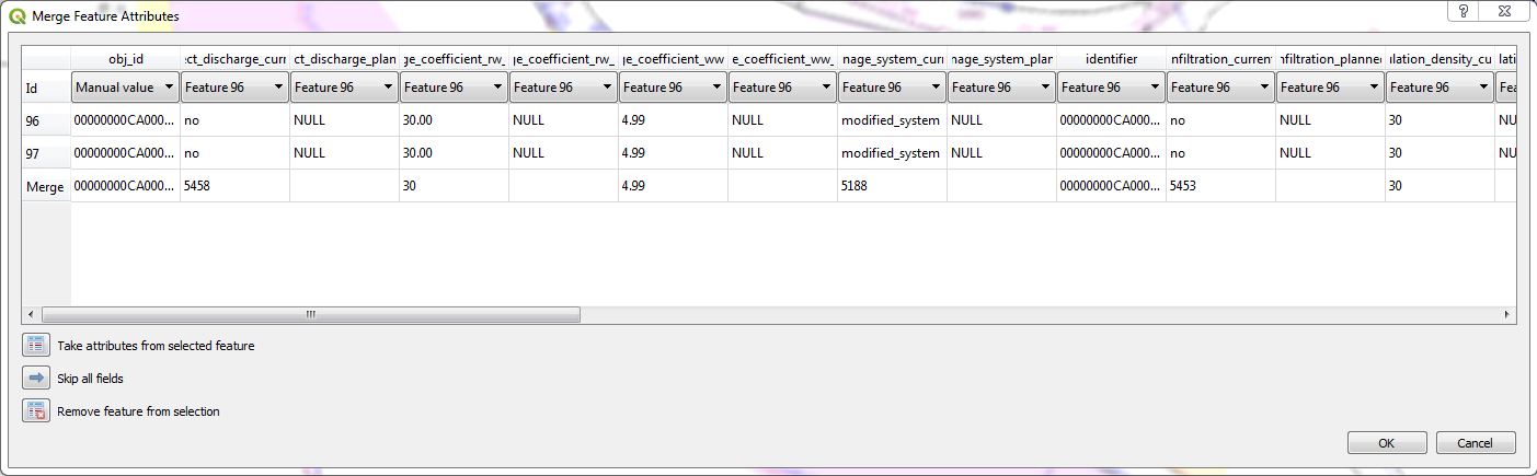
Choose which values will be taken from which old record and click OK.
Attention
If you select one of the records and click on the Take attributes from the selected feature button, then the obj_id field will be skipped by default and the database will not accept the changes. After using this button, you have to choose one of the values in the obj_id field manually.
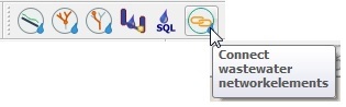
3.2.7.6. Connect Catchment area to Wastewater Network Nodes
You connect catchment areas with the tool Connect wastewater networkelements (it’s the same tool to connect reaches and nodes described in the chapter Editing in QGEP).
It does not matter, which layer is selected
The catchment_area layer has to be in edit mode
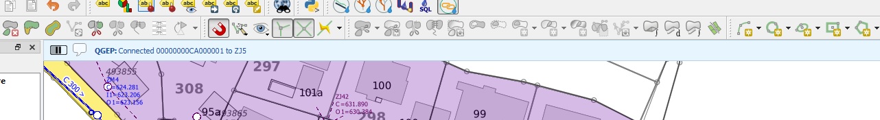
Click the Connect wastewater networkelements button
If you move the mouse over an catchment area near the border of the catchment area, it is marked: you can click to choose this record
Move the mouse to the networkelement, to which the catchment area will by connected (again: selectable objects get marked) and click again
A window appears, where you can choose, which connection(s) will be defined.
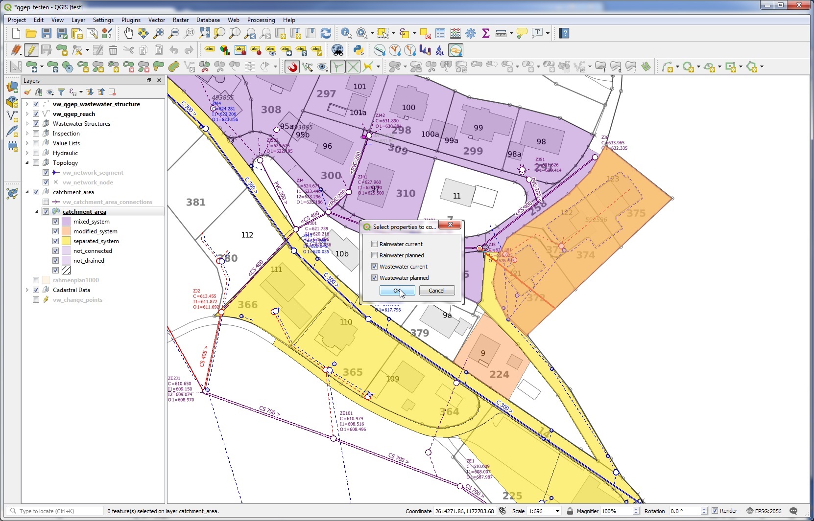
If everything is ok, you will see a message in a blue bar on top of the map-window
Note
In the VSA-DSS-Datamodel, it is possible to connect catchment_areas to wastewater nodes or to reaches. Because a lot of hydraulic calculation do not support connections to reaches, this tool in qgep connects only to wastewater nodes and not to reaches.
Note
The tool does not check, if your choosen wastewater node is a part of the pwwf-network (primary network). It’s only the user who decides, if a node is ok or not. If you are not sure, please check the VSA Wegleitung GEP-Daten, part Erfassungsgrundsätze
You can not connect multiple areas with the tool to a wastewater node at once. If you want to do so, you have to select the catchment areas, open the attribute table and then start the multi edit mode. There you can choose the wastewater node from the list of all nodes.
Do delete a connection to a wastewater node, you can edit the area with the Identify features tool.