3.2.8. Importing data
It is quite easy to import data (geometry and attributes) from an external software. Here is a general description and a specific example.
3.2.8.1. Généralités
You have to add the data you want to import as (vector) layer into the QGEP project.
The field names of the attributes have to be the same as the field names of the QGEP Layer. Therefore it is normally not a good idea the use shp-files, because of the 10 letters limitation of the dbf-format (Alias field names do not work).
If you have a translated project, be sure to take the English field names (not the translated name that you find as Alias of the field).
If there is a field with value list, you have to use the code, not the plain text.
If your fields are prepared as described above, then just copy and paste in the QGEP-layer.
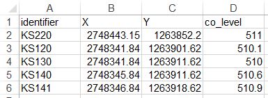
3.2.8.2. Example Importing manholes from a TXT-File:
Change the field names to identifier, x, y, co_level
Open the txt-file with .
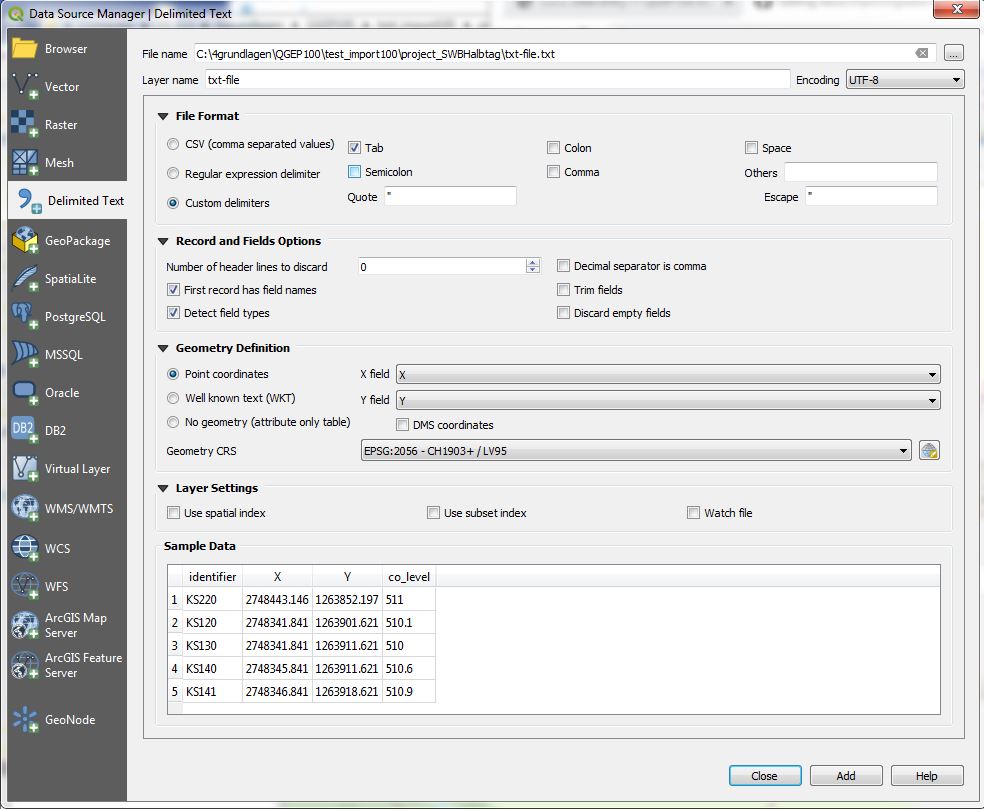
You have now a vector-layer with your points in the QGEP-project
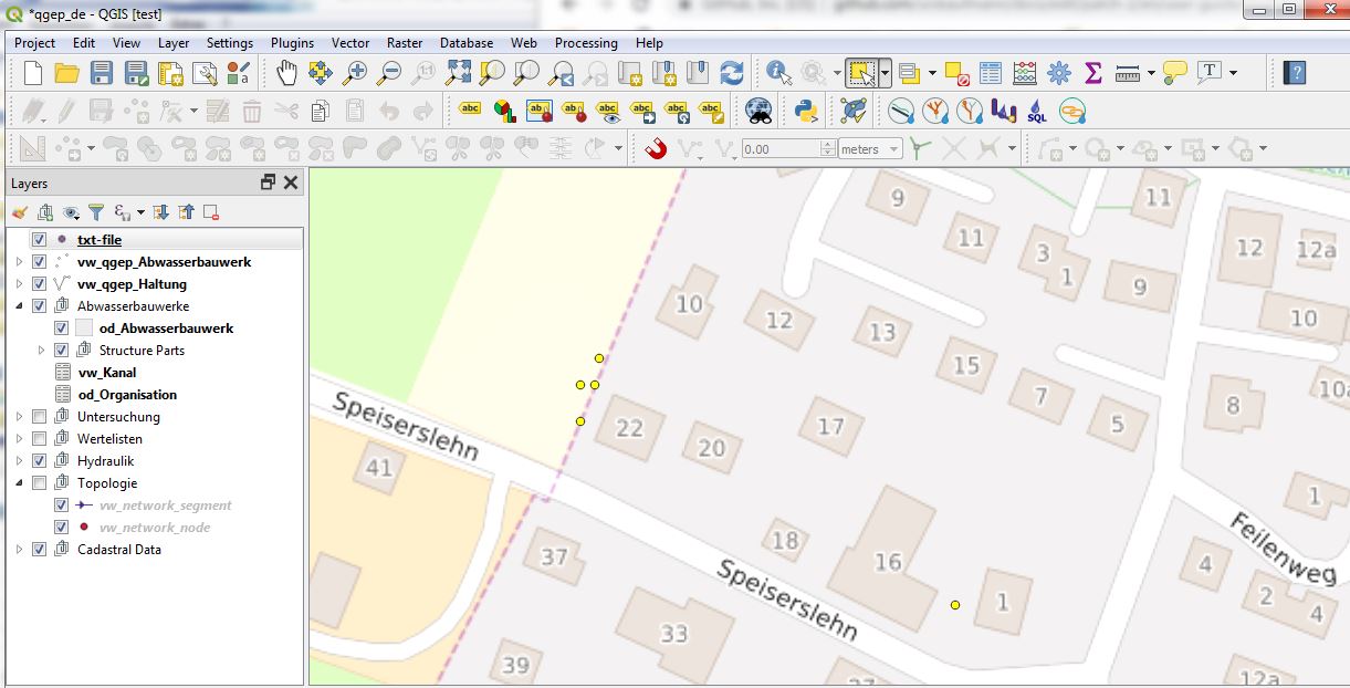
Sélectionnez les points de la nouvelle couche
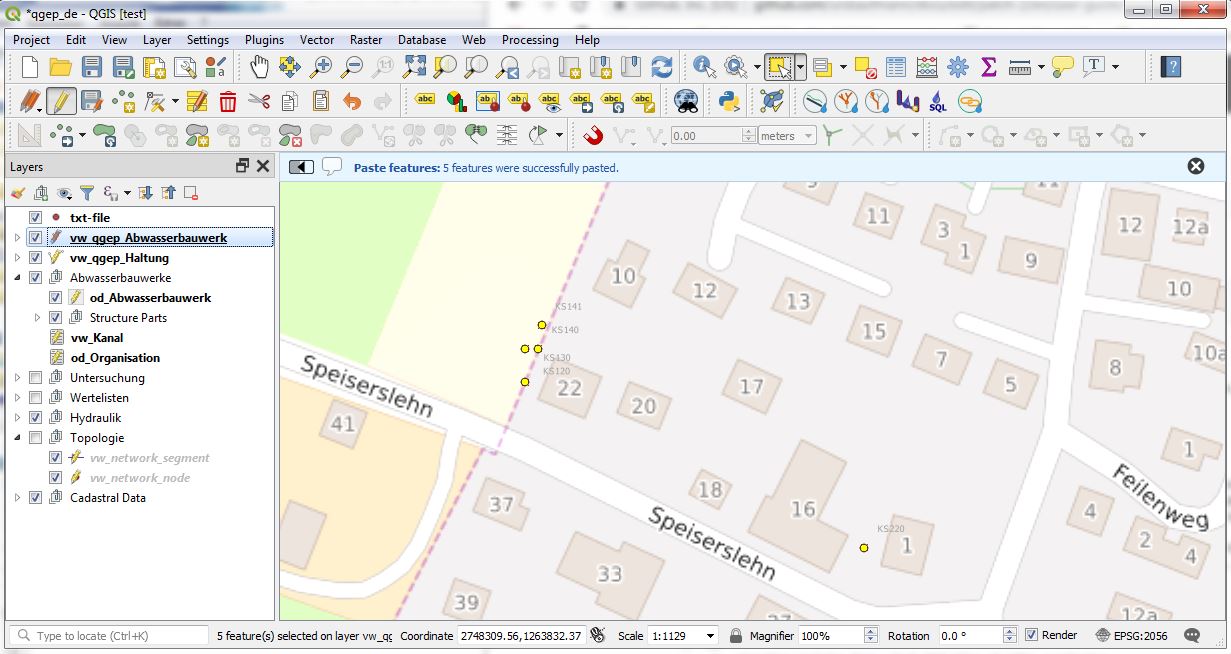
Choose .
Select the vw_qgep_wastewater_structure layer and set it editable
Choose .
Note
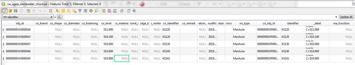
The ws_type is set as default to manhole. The identifier is used not only for the wastewater_structure, but also as cover_identifier and as wastewaternode_identifier.
3.2.8.3. Example Importing manholes with attributes:
Example to add additional attributes
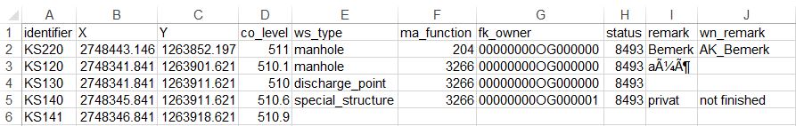
The field ws_type is an exception. Possible values are manhole, special_structure, infiltration_installation, discharge_point.
For other fields with value lists you have to use the code.
In the example above, the values for ma_function in the row discharge_point or special_structure has no effect.