QGEP a plusieurs couches prédéfinies. Pour plus d’informations, voir le chapitre Explication des couches.
3.3.1.3. Changer les attributs des éléments de type point (chambres / structures spéciales)
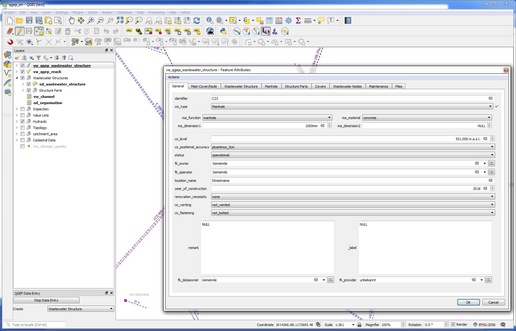
Pour changer un attribut, vous devez d’abord sélectionner la couche vw_qgep_wastewater_structure.
Switch to the edit mode or start the QGEP Wizard and click on Start Data Entry.
Then click on the Identify features button and click on the element you want to edit.
Le formulaire vw_qgep_ouvrage_assainissement va s’ouvrir.
On the first tab (General) you can change the most common attributes
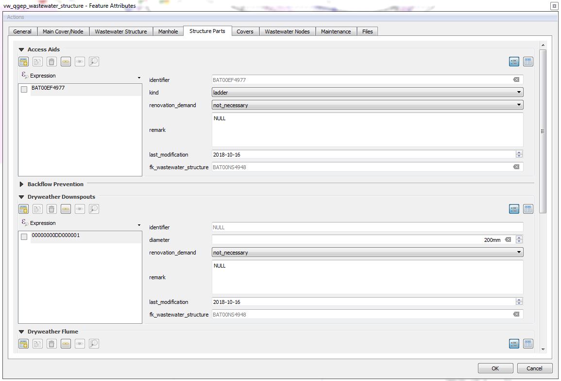
Pour modifier les attributs de tables liées aux structures d’assainissement (p. ex. couvercle), vous devez sélectionnez l’onglet correspondant. Des attributs additionnels peuvent être édités selon le type de structures (structure spéciale, regard).
In Structure parts tab you can add further parts such as access aids, backflow prevention, dryweather flume etc.
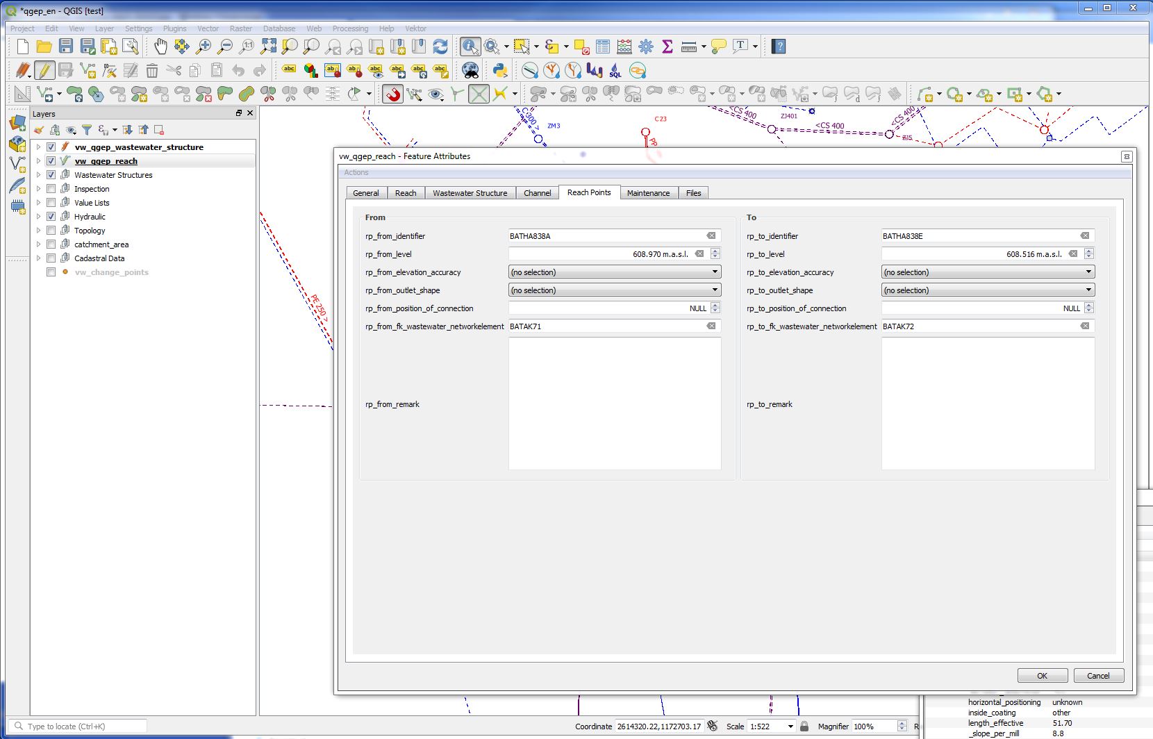
The definition in VSA-DSS is, that reaches have to be defined in the flow direction (the start node is where the water comes from, the end node is where the water flows).
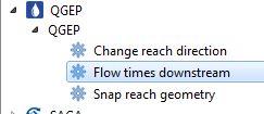
QGEP has a tool to change the reach direction. With this tool you can change all selected reaches at once.
Do not use the Reverse line button of QGIS, because this button do not change the reach points and their connection to wastewater network elements.
Pour commencer, vous devez sélectionner tous les tronçons que vous souhaitez modifier. Il n’est pas nécessaire de sélectionner la couche vw_qgep_troncon ou de passer cette couche en mode d’édition.
Open the Processing Toolbox
Faites un double clic sur l’outil Changer la direction du tronçon
In the tool window you have to choose the vw_qgep_reach - Layer and then click on Run
If you zoom in or out, you see, that the slope-arrow and the slope has changed. The reach points level have not changed.
Rafraîchissez la topologie du réseau.
Vous pouvez maintenant enregistrer la modification.
Cet outil accroche graphiquement les tronçons à l’élément du réseau assainissement auquel ils sont connectés. Ils sont ainsi connectés non seulement de manière logique mais également de manière graphique.
To start you have to select all reaches that you want to snap. There is no need to select the vw_qgep_reach layer or to set this layer to the edit mode.
Open the Processing Toolbox
Double click the Snap reach geometry tool
In the tool window you have to choose the vw_qgep_reach - layer and the vw_wastewater_node - layer, then click on Run
Si vous zoomez en avant ou en arrière, vous voyez les modifications.
If the result is not what you expect, try with a greater snapping distance
If there are connections from reach to reach, the reach point moves at right angles to the other reach. If there is no way to do a right angle, it moves to the next end point of the reach.
Attention
If there is snapping from reach to reach, you will get not the expected result, if the first reach snaps to a second reach, and afterwards this second reach snaps to a node or a third reach, there will be no more graphical connection between reach 1 and reach 2. You have to rerun the command.
The values of fields with value list are stored in the database with codes.
Note
The codes are unique, also if there is the same text in different value lists. E.g. the code for « rain_wastewater » in the vl_channel_usage_current and in the vl_channel_usage_planned is different.
Dans un projet Qgep correctement configuré, les vues des tables ou des formulaires doivent afficher les valeurs dans votre langue et non les codes.
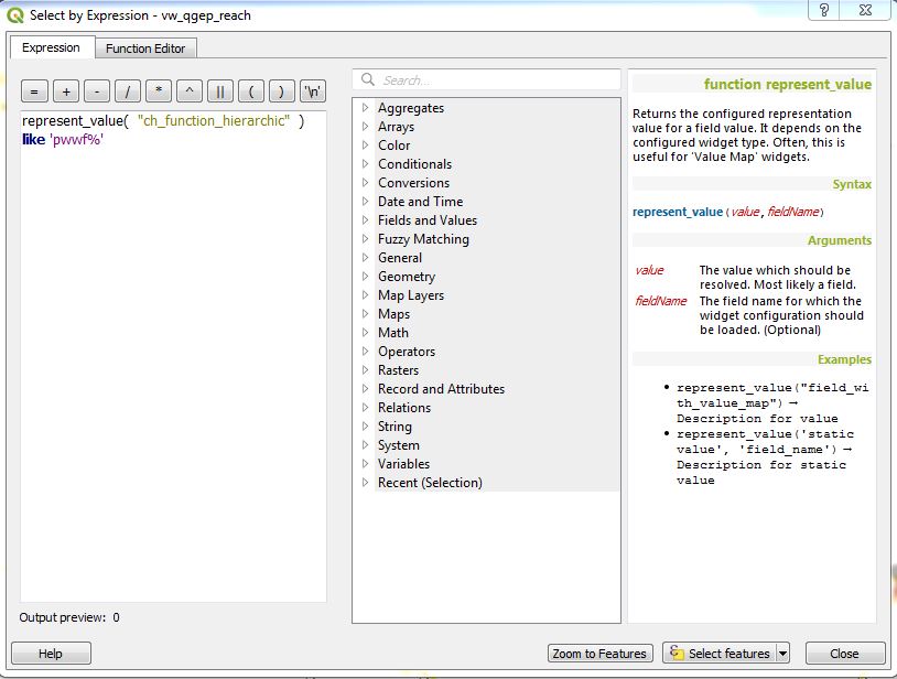
Mais si vous voulez définir une sélection avec une expression ou si vous vous voulez définir une symbologie basée sur des règles pour votre couche, vous devez connaître les codes ou utiliser l’expression suivante: represent_value(« field »)
Examples for using represent_value
Search all primary wastewater facility reaches (function_hierarchic starts with pwwf)
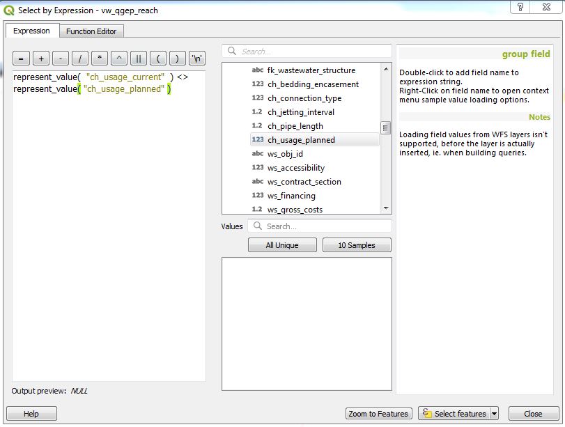
Sélectionner tous les tronçons n’ayant pas la même valeur pour usage_planifié et usage_courant
Note
L’expression « co_usage_courant » <> « co_usage planifie » ne fonctionne pas à cause des codes uniques!
Note
Dans le projet démo il n’y a pas d’utilisation de valeur_representation pour les symboles basés sur des règles, sinon les règles ne vont fonctionner que pour un seul langage.
Avec l’outil Identifier une entité activé, un clic droit sur un élément affichera une sélection de tous les objets existants.
Vous pouvez alors sélectionner l’objet désiré. Ceci ouvrira le formulaire correspondant contenant les informations détaillées.
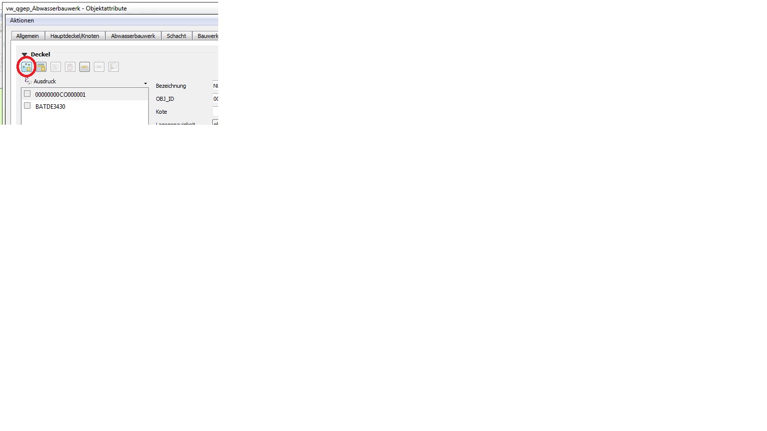
3.3.1.9. Ajouter des couvercles et noeuds additionnels à une structure assainissement existante
Note
The following description is for an additional cover. It works similar for additional wastewater nodes.
S’assurer que la relation entre les tables vw_couvercle (champ « fk_ouvrage_assainissement ») et vw_qgep_ouvrage_assainissement (champ « obj_id ») soit bien présente dans Propriétés du projet / Relations
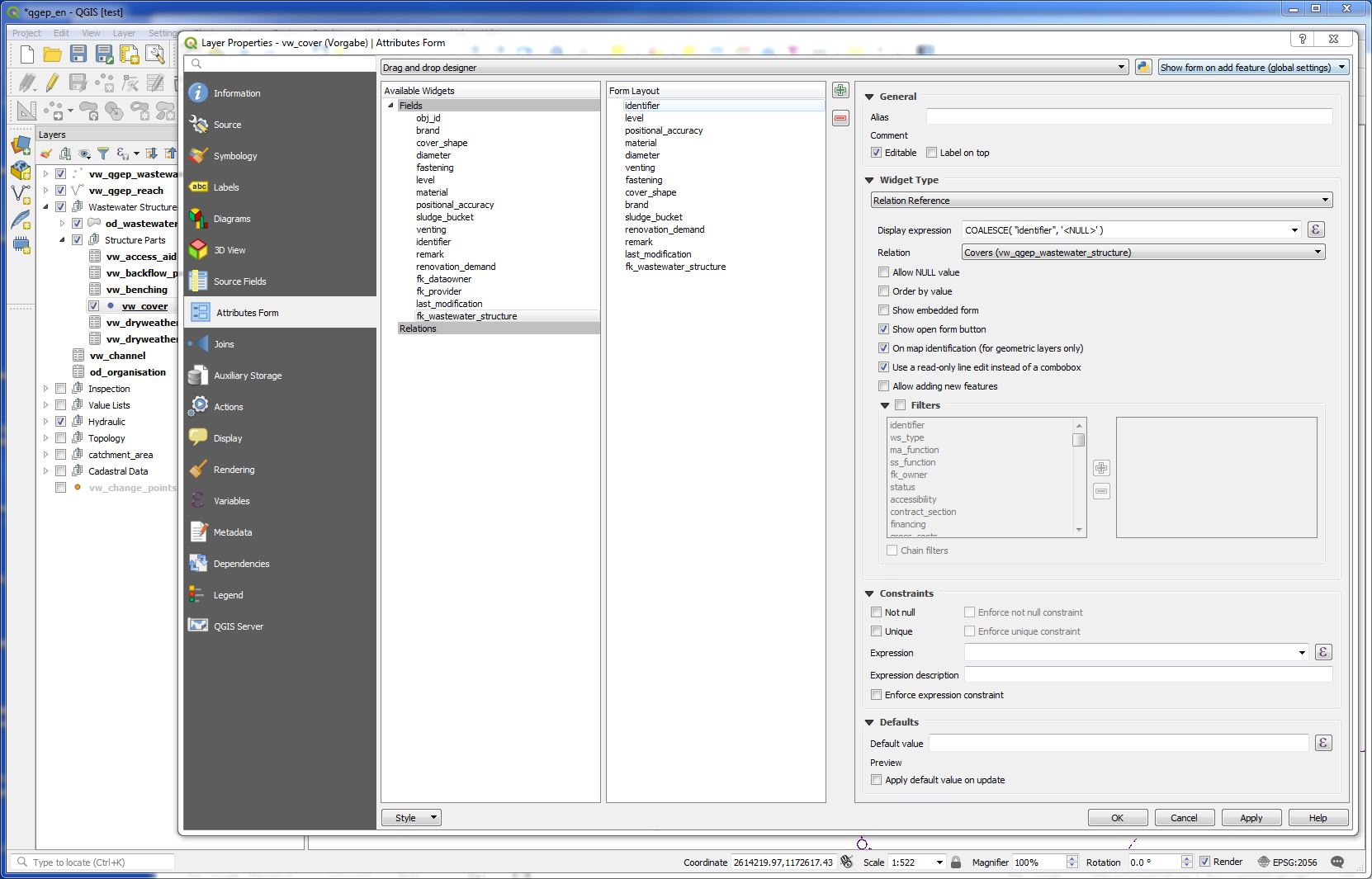
Define in layer vw_cover / Properties / Attribute Forms the field fk_wastewater_structure as value relation
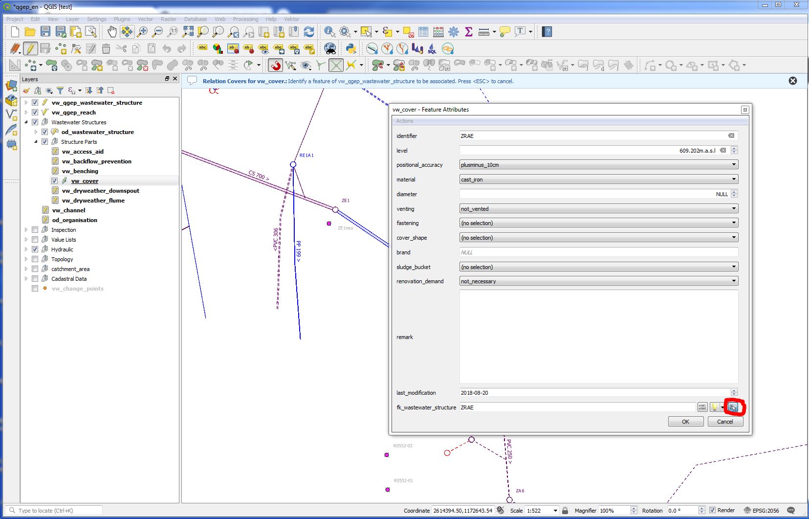
With QGIS 3.16 there is a new way: select layer vw_qgep_wastewater_structure, set it editable, click the manhole you want to add a cover with the Identify feature tool. Go to tab covers and click the new child point-button. Now you can digitize a new cover for the wastewater structure.
The other way (before QGIS 3.16)
Commencez par éditer la couche vw_couvercle et ajoutez le nouveau couvercle
Dans le formulaire, derrière le champ fk_structure_assainissement, vous trouverez un bouton pour connecter le nouveau couvercle à une structure assainissement existante.
After clicking this button, you get blue hint in the qgis-window. You can move the vw_cover - form-window and click on the wastewater_structure, that will be associated to the cover.
3.3.1.10. Ajouter un noeud assainissement à un tronçon existant
In some cases, you need to add a wastewater node between two or more reaches, although there is no manhole at this place.
Note
This cases are mainly in pwwf_channels (primary wastewater facilities) if there is e.g. a change of slope or a change of the material or if there is a connection of two channels without manhole (in German: Blindanschluss).
In the data model, you can connect a node between reaches to a channel (because also a channel is a wastewater structure). There is in the moment a discussion, if it is necessary or optional or even forbidden to define a connection to a wastewater structure.
In QGEP, there is in the moment no tool, that helps you to connect a wastewater node to a channel. So you just connect the reach points to the node.
Note
If you really want to connect the node to a channel, then type the obj_id of the channel manually in the fk_wasterwater_structure field of the node.
Cliquez sur Sauver et désactivez ensuite le mode d’édition ou cliquez sur Terminer l’entrée de données si vous avez travaillé avec l’assistant de saisie de données QGEP (wizard).
In the vw_qgep_wastewater_structure form, you can change the subclass of the wastewater structure (e.g. from manhole to special structure or to infiltration installation). The old subclass-record will be deleted and you must enter those attributes, that are subclass specific. But all connections (they are defined to the class wastewater_structure and not to the subclass) or the obj_id or the identifier will not change.
Note
Vous ne pouvez pas changer un élément ponctuel assainissement (p.ex. regard) en élément linéaire assainissement (p.ex. conduite) ou vice versa.
3.3.1.14. Séparer un tronçon (conduite) en différents tronçons
This is a quite complex function and not jet implemented in QGEP. There exists a QGIS-Tool to split objects, but if you use this tool with vw_qgep_reach - layer, you will get a database error, because the obj_id of the split (= duplicated) records are no more unique.
Solution temporaire: Changez le tronçon existant et dessinez le second tronçon manuellement. Contrôlez les connexions.
There will be later a tool in QGEP to split reaches. The user has to decide, if splitting concerns only class reach or also the class channel, if there a new wastewater node shall be added and connected. The tool shall be able to calculate the new reachpoint - levels and should change the existing network-element-connections if necessary.